Friday, 9 September 2011

WEEK 7 LECTURE & TUTORIAL:

We had our week 7 tutorial today and it was interesting to see what Jane had to say about our presentation last week. I was very happy to hear that we passed! My initial thoughts after last week was that we would each design a different light rail terminal as different ‘gateways’ into the capital. After talking with Jane though, we decided that we had to create something that was a mobile form of architecture, not just a concept built on the movement of people. So, from this, we started thinking about changes/ additions we could do to the light rail to try and incorporate something that was more based on the mobility concept. After Claire and I looked up the actual meaning of mobile (able to move or be moved freely), these were some initial thoughts:
-        Moving terminals: terminals that are mobile around Canberra
-        Moving what is happening at each station: have an activity/function/program/ that is able to be moved around to the different stations in Canberra
-        Moving a precinct- increasing mobility/ creating a portable structure within an area around a station: providing a function around the main civic centre
-        Moving the ‘experience’: take on a aspect (cultural) and enhance this concept through the sequence of events for the user through a mobile device
Claire is pretty certain that she is going to focus on the Russel area, and create a terminal and form of mobile architecture within the area, around the proposed light rail station. I think this is a key area as it acts somewhat of an entrance into the city, where you can either travel by light rail to the Capitol Hill area or into the city. To continue on with this theory, I think I might focus on the city/museum area as this is the main cultural district or Canberra and has the most activity. There could also be potential to extend this to the parliament house and the cultural functions that take place around the hill. At this stage I am a bit unsure where to take the project, but I think I might focus on the cultural/tourist side to the proposal and try to enhance the rail even further by creating something that runs in conjunction with the light rail.
Maybe this could be trying to introduce something like the New York Highline that is portable to create small public places that can move to suit the needs of the city. Sometimes this could be situated next to the museum station that looks out to the water to create a general public area. This could have the potential to draw more people in and create more lively public areas. Could these be small hubs or TOD’S? Could this even encourage more built up areas and development? These hubs could then move to the parliament station when there is an important function or public event? This could create something that the general public can relate to and not make everything so formal- more informal/flexible spaces for everyone to enjoy, not segregated groups.
Maybe this has to be something more specific; I’m just not sure what at this stage. It’s easy enough to say a ‘public space’, but what does that really mean. What other function could this serve to make it truly viable? How can I create something that will enhance the light rail and parliament, while allowing it to moveable? How can I create something that really makes sense?

Friday, 2 September 2011

CHANGES TO PRESENTATION:

This is a quick layout I did for the second and third panel to be improved. I think the new layout for the second panel would have explained the concept a bit better in terms of the light rail itself, as well a new third panel layout that would have brought our proposal together and given a more realistic impression:


I think we could have also created a better flow between the first and second panel. Maybe we could have introduced the actual light rail concept on the first panel which led into the second panel with how we are implementing the strategy. There is obviously nothing we can do about our final project 1 submission, so the only way is forward now and that means the actual designing of part of our scheme. We have a general outline of what we will do now (designing different nodes/entrances/gateways into Canberra) but we will have to discuss the fine details of where we will each go from here in this weeks tutorial!


FINAL PANELS & POST-PRESENTATION REFLECTION:

We had our presentation today and it sadly didn't go as well as expected. Firstly, there were major issues with the printing and finishing off the panels. When we delegated the tasks, Claire was to do the first panel, I was to do the second and Dee was to do the third. The first two panels were printed in time but Dee had a massive issue with the sketch up model she was working in to create 3d views of the light rail. The program crashed and she lost most of her work so the last panel didn't display all the information that we wanted to show. I think this panel could have potentially summed up our proposal and given a more holistic impression of the network if it was completed, so it was a shame that Dee had such bad luck. In looking back on my panel, I wish I had incorporated some facts and information about the light rail itself, as I did a lot of research into it. I definitely feel that this form of infrastructure would be very beneficial to Canberra, so I wish our group had shown off the reasons why we chose this scheme more effectively... so more to do with the 'why' and not just the 'how'.

These are the points why the light rail is the best option in comparison to other forms of transport and why it is viable for Canberra. A lot of these facts were taken from the Sunshine Coast Proposal which I mentioned earlier in my research development:

·        Light rail moves passengers in short trains at less than 8 minute intervals either in a median strip or shared zone area with street traffic. It is a more suitable public transport method as it can service areas that are already developed. As much of Canberra is either developed or parks, the system could be integrated into the medium strips on main roads or as an extra lane on smaller roads.

·        Light rail produces no pollution to the immediate atmosphere, reducing smog and improving air quality in built up areas.

·        There is a predicted rise in the ageing population so there is a need for a more accessible public transport network in Canberra.

·        Light rail infrastructure generates much greater passenger numbers than most bus based systems and integration with all other modes of transport is key. Better transport infrastructure creates significant growth in people using public transport, which will mean less people are using cars, which is better for the environment.

·        There is a need to integrate all forms of transport as a network- both public and private. This could include the airport, marinas, bus ways, cycle ways, railway, park and ride facilities, to provide greater connectivity and a more accessible capital.

·        The elevated system-  Min. Footprint and allows room for existing modes of transport.
-        Ease of construction as most elements can be pre cast and installed on site quickly.
-        Views are created of town and makes for a more scenic/tourist trip.
-        No conflict between traffic lights, pedestrians and other modes of transport.
-        Lower running costs as the vehicles can be fully automated.
-        Allows integration with power lines and lamp posts to offer opportunities of beautification.
-        Lower risk of accidents- faster speed.
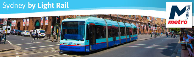
Other research I conducted along the way was into Sydney’s light rail system that connects the main hub and surrounding suburbs. It almost looks like a large bus/tram and adds character to the streets:
 “Sydney Fish Markets, Star City Casino, Darling Harbour and Chinatown are all on the list of destinations easily accessible by Sydney Light Rail. Light Rail links the hub of Central Station and Sydney's Inner Western Suburbs via Haymarket, Pyrmont, Glebe and Rozelle. The most desirable commuter transport in Sydney, Sydney Light Rail is environmentally responsible, comfortable, convenient and efficient. Light Rail tickets are available from our friendly conductors on-board each tram. Services are so frequent that you just need to turn up and go”.

I also wish that we had of emphasised the way in which creating new nodes of transport into the central area of Canberra will create new ‘gateways’ into the capital. We wanted to enhance the mobility within Canberra to move the people, and allow Canberra to stay as an exemplar city for the rest of the continent. As the city is the capital, there needs to be a few strong and powerful entrance corridors/gateways that portray this meaning. Looking back, I think the proposal would have been more powerful if we presented this information also to give more reasoning as to why we chose a light rail network. These will be the avenues that we will be able to take now for the second part of the assignment- designing forms of architecture that create true entrance points into the capital and link the city together.

These were the final panels for the presentation and the links to the PDF of each one...


Thursday, 1 September 2011

Project Progress 05...

This is the final panel layout for panel 2, without the main headings added:


Project Progress 04...

This was the second attempt at trying to create a project statement that sums up our proposal:
Our group has proposed to convert every state in Australia into a separate country with its own parliamentary system. This will allow each country to be more self sufficient and sustainable, and possibly reduce migration and travelling around such a mass area. Canberra will ultimately act as a ‘union’ and meeting place for all of these countries to gather and discuss common issues, which is why improving mobility within Canberra is essential for the future.
Canberra is very spread out with the only form of public transport being buses, and a main focus on walking and cycling. It is near impossible however for everyone to be able to access all areas of the capital both easily and cheaply. This affects everyone from tourists holidaying in the city, people living in the area, children visiting the capital for school camps, and politicians staying in the city whilst using Parliament House on a regular basis.
So, we have devised a new light rail network that connects all major areas in the city to enhance mobility within Canberra. This will in turn attract people to the capital and allow Canberra to appeal to a wider demographic of people.  The proposed network will create an additional layer on top of the current infrastructure, with the majority of rail elevated above median strips of main roads within Canberra. Links to the existing airport and country rail will be designed to allow people coming in and out of Canberra easy access to the centre of the city and Parliament house. All main tourist attractions are connected for visitors, and routes that join surrounding suburbs with the centre are implemented for residents. There are also proposed stations at common school camp accommodation and local politician lodges within the city that connects to Capital Hill. The Parliament house station has been strategically placed to not interfere with the precinct, and all stations across the area are positioned to avoid the blocking of views to Capital Hill. Improved scale and proportion within large streets and unused spaces across the city is also a main strategy, with the possibility left open to create urban spaces on the elevated rail for future densification.
Overall the proposal will promote and cater for future population growth within Canberra through creating an area that is both mobile and accessible and provide a common ground for every politician representing each country.

Project Progress 03...

After creating the base map to show where each stop was positioned over Canberra and the connectivity within the city that the network will provide, I started to create a base diagram to apply different layering over the city infrastructure. These are designed to show political, social, cultural and physical aspects of what is needed for our light rail proposal. Originally I used the diagram shown below using a 3d aerial map, where I was going to create each layer over the top of the existing street network:


After some more playing around with Photoshop and Illustrator, as well as some help from Claire, I changed the map so the layering is easier to read and makes more of an impact. To represent each relation between the rail and its purpose/outcome (cultural, social, physical and political), I highlighted each series of stops in a different colour. The cultural links connect all tourist attractions in Canberra, social links connect stops like universities, hospitals and suburbs to service the community, the political links connect school camp accomodation and politicians lodges within the city to capital hill, and the physical connection is a 3d diagram showing the existing road network that is used to support our proposal. All of these are linked to the existing country rail link and the airport to create direct access in and out of the city:

CULTURAL

SOCIAL


POLITICAL


PHYSICAL


Project Progress 02...

This is the final map for the presentation panel 02 that includes the stations for the  light rail network. The main route/connections have been emphasized in bold to represent the increased mobility between the main areas of Canberra. Below is a list of the proposed stations in relation to the numbers on the map:


1)      Existing country link rail to Sydney Station
2)      Parliament house Station
3)      Tourism Precinct Station: Nation Gallery of Australia, Old Parliament House, High Court of  Australia, National Library of Australia, National Science and Technology Centre, National Archives of Australia
4)      Russel Station/War Memorial
5)      Existing airport station
6)      City Station
7)      Braddon Station
8)      Race course and Exhibition Park Station
9)      Canberra Motor Village Station: School camp accommodation
10)   Bush Capital Lodge Station : School camp accommodation
11)   Calvery Hospital Station
12)   International Sports and Aquatic Centre & University of Canberra Station
13)   Aranda/National Park Station
14)   Acton/Botanic Gardens Station
15)   National Museum of Australia Station
16)   National Zoo and Aquarium Station
17)   Curtin Station
18)   Royal Australian Mint & John James Hospital Station
19)   National Capital Private Hospital Station
20)   Red Hill Station
21)   Fyshwick Station